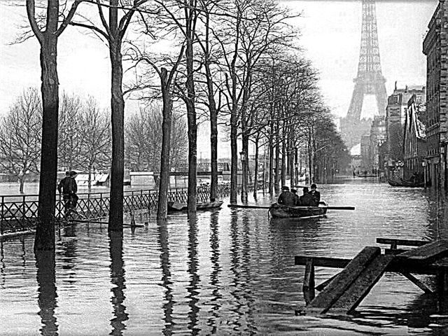
More than a thousand large and small rivers flow in the Smolensk region, the largest of them cross the territories of several states. Many of them in the old days were part of important waterways, including the famous route "from the Varangians to the Greeks." Now the rivers of the Smolensk region form a powerful water system, which, among other things, provides water supply to the capital of Russia - Moscow.
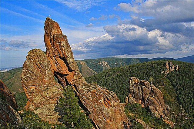
The rivers of the Smolensk region are of interest as a tourist route, many of them have bases for tourists and fishermen. Many reservoirs have received the nickname "fish rivers". On the banks there are many testimonies of the past of our country - burial mounds, ancient settlements. The shores are rich in medicinal plants and rare bird species. There are nature reserves.
The longest rivers of the Smolensk region
List of the largest rivers flowing through the region.
Dnieper
One of the largest European rivers. The old name is Slavutich. The source is located in the Akseninsky moss tract in the Sychevsky district of the Smolensk region. It crosses the territory of Belarus and Ukraine, flows into the Black Sea. On the territory of the Smolensk region, the channel is shallow, flows through wooded and swampy areas. Pike, silver bream, perch, roach, tench, and others are found from fish.
The length of the river is 2201 km, in the Smolensk region - 485 km.
Gum
The largest of the tributaries of the Dnieper. The source is located in the Golubev Mokh swamp not far from Yelnya. Crosses the Smolensk and Bryansk regions of the Russian Federation, Kiev, Chernigov, Sumy regions of Ukraine. On the river is the Desnogorsk reservoir 44 km long, created for the Smolensk nuclear power plant. In the Smolensk region, the shores of the Desna are low-lying, swampy. In the old days, the river was part of the water trade routes.
The total length of the river is 1130 km.

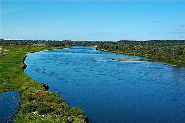
Western Dvina
The source is in the Tver region, the river crosses Belarus and Latvia, flows into the Gulf of Riga. Before it flows into the lake, Ovat flows in the form of a small stream called Dvinets. In the Smolensk region, it flows along its northwestern outskirts. The channel width in the Smolensk region is about 20 meters, then it gradually increases. On the shores there are mountain limestones, coal beds. There are small rapids and rifts along the river.
The total length of the river is 1020 km.

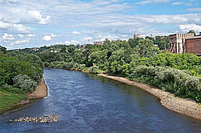
Sozh
The second longest tributary of the Dnieper. Source - Smolensk-Moscow Upland near Smolensk, flows into the Dnieper on the territory of the Gomel region of Belarus. On the territory of the Smolensk region, the river is small, the channel is meandering. There are many bottom rifts. The tributaries in the Smolensk region are Vikhra and Oster. On the banks of the villages of Koschino and Kushlyanshchina there are barrows of the 9th-11th centuries.
The length of the river is 648 km, in the Smolensk region - 155 km.

Moscow
Left tributary of the Oka. The source is located on the border with the Moscow region, near the Starkovo tract. The beginning of the river - the Moskvoretsky brook is marked with a memorial sign with a small chapel next to it. There is also a recreation area and an artesian well. Mikhalevskoe Lake crosses the territory of the Smolensk region. The river is known as part of the water trade routes that in the old days connected Smolensk with Novgorod.
The total length of the river is 473 km.

Iput
The largest tributary of the Sozh River. On the territory of Russia, it flows through the Smolensk and Bryansk regions. In the Smolensk region, it crosses the Ershichi district, including its center - the village of Ershitsa. There are many archaeological monuments on the shores - about 50 settlements of the ancient Slavs, sites from the Stone Age. The river is known among boaters as a rafting route.
The total length of the river is 437 km.

Ugra
The source is located in the Yelninsky district. The source valley has been declared a protected natural object, part of the Ugra National Park. The river also flows through the Glinkovsky and Demidovsky districts, and in the Kaluga region, where it flows into the Oka. From the source, the Ugra flows in the form of a stream, the channel becomes wider near the village of Vysokoe. In history it is known as a place of "standing on the Ugra".
The total length of the river is 399 km.

Oster
Left tributary of the Sozh River. It flows in the Smolensk region and on the border with the Republic of Belarus. The source is located in the Pochinkovsky district, on the Smolensk Upland, flows through the Roslavl and Shumyach districts. From the source, the floodplain of the river is swampy, its width is about 40-50 meters. The largest tributaries are Ostrik, Stomet, Bolshaya Navlya.
The length of the river is 274 km.

Conversation
In the Smolensk region, it flows only in the Ershichi district, it originates from the village of Besedka. On the territory of the Russian Federation, it also flows in the Bryansk region, the channel crosses the border with Belarus three times. The river bed is winding, there are many sandy islets. The average width is about 30-40 meters. From fish roach, pike, perch are found. Some sections of the river are used as tourist rafting routes.
The total length of the river is 261 km.

Thief
Left tributary of the Ugra. It flows mainly through the Smolensk region, a small section in the source area - the Moscow region. The largest tributaries are Polot, Istra, Mogilenka, Receive. The shores are mostly flat, swampy, with birch and spruce forests. The name supposedly comes from the Finnish vuori - "forest". Popular with tourists for kayaking and fishermen.
The total length of the river is 167 km.

Vazuza
It flows in the Smolensk and Tver regions. The source is not far from the village of Maryino, Vyazemsky District, in the northern part of the Smolensk Upland. The Vazuz reservoir was built on the river bed. Besides being used for hydroelectric power plants, it is known as a tourist area. Fishing bases and camp sites are located on the shores. The river is recognized as one of the cleanest bodies of water in the Russian Federation.
The total length of the river is 162 km.

Yell
The source is located in the northern part of the Smolensk region, not far from the village of Kleshnino Kholm-Zhirkovsky district. The confluence with the Dnieper is located near the village of Solovyevo, Kardymovskiy district. The largest settlement on the river is the city of Yartsevo. The river is used for boating and fishing. In the upper course, the river bed becomes shallower, in places it dries up. The banks are wooded, swampy.
The length of the river is 158 km.

Whirlwind
Tributary of the Sozh River. The source is located on the southern side of the Smolensk Upland, near the village of Korytnya. In the Smolensk region it flows through the Smolensk and Monastyrshchinsky districts. The estuary is not far from the village of Ponar, Khislavichsky district, on the border with Belarus. The channel of the Vikhra is very meandering, the banks are mostly swampy.
The length of the river is 158 km, in the Smolensk region - 128 km.

Obsha
The source is located near the village of Bocharovo in the Sychevsky district, on the Belskaya Upland. It flows into the Mezha River in the Tver region. In the Smolensk region there is only the upper course of the river, there are practically no settlements. Obsha is popular with fishermen, there are pike, dace, carp and other types of fish. It is also used as a rafting tourist route.
The total length of the river is 153 km.

Vyazma
The source is swamps near the village of Belivitsy, Vyazemsky district, flows through the city of Vyazma. It merges with the Dnieper along its left bank near the village of Ustye. The largest tributaries are Zhutenka, Novoselka, Sarogosh, Boldan. Within the city limits, Vyazma is distinguished by a shallow channel and debris. After Artyomov it is suitable for fishing and tourist rafting. Previously, it was navigable.
The length of the river is 147 km.

Kasplya
The source is Lake Kasplya in the northeastern part of the Smolensk region. It flows into the Western Dvina on the territory of the Vitebsk region of Belarus. In the Smolensk region, it flows in the Demidovsky, Smolensk, Rudnyansky regions. The channel width is 25-30 meters. The valley is known for the abundance of archaeological monuments - barrows, ancient settlements. Used for boating as a rafting route. It is also popular as an object of recreational fishing.
The total length of the river is 136 km.

Dumbness
Refers to the right tributaries of the Dnieper. The source is located near the village of Bobyli, Dukhovshchinsky district. It also flows through the Kardymovsky district, where a hydroelectric power station was built on the riverbed.The river valley is swampy, in the floodplain there are rare plants, including the perennial lunar. Khmosti has 46 tributaries in total. It is known as the place of the front line during the Great Patriotic War. In the old days - part of the way "from the Varangians to the Greeks."
The length of the river is 135 km.

Shan
It originates in the Temkinsky region, before crossing with the Velikaya River, it bears the name of the Big Shan. It flows into the Ugra along its left bank in the Kaluga region. The current is meandering, it flows mainly through marshland. There are mixed birch-aspen forests. In the upper part of the stream there is a nature reserve of regional significance. The Shan water is polluted in most of the channel.
The length of the river is 131 km.

Fable
It flows in Vyazemsky, Sychevsky, Novoduginsky regions. The source is not far from the village of Novoye Selo in the eastern part of the Vyazemskaya Upland. It flows into Vazuzu along its right bank, 62 km from the mouth in the Sychevsky region. The largest tributaries are Ruza, Abolonka, Gorodnya. After the construction of the Vazuz reservoir, the channel widened significantly, the river overflowed. It is known as a popular fishing destination all year round.
The length of the river is 107 km.

The axis
The source is located in the Zhdanovsky district, not far from the Zhdanovka railway station. It flows into the Dnieper along its left bank in the territory of the city of Dorogobuzh. The river bed is very winding, some of the banks are steep, with cliffs. There are small rapids downstream. The name comes from the Latvian word meaning "stone, stone". Chub, dace, pike, perch are found in the river.
The length of the river is 104 km.

Osuga
It flows out of a spring near the village of Zavidovo in the Tver region. It flows into Vazuza along its left bank also in the Tver region, in the Zubtsovsky district. It flows through the Smolensk region only in the Sychevsky region. There is a nature reserve in the upper reaches of the stream. The channel forms a natural border of the two regions. It is known among fishermen as a place where there is a lot of fish, among tourists - as a rafting route.
The length of the river is 100 km.

Tsarevich
It flows in Yartsevsky and Dukhovshchinsky districts. The source is not far from the village of Voronino. It flows into the Vop River along its right bank near the village of Skachikhino, Yartsevsky District. The largest tributaries are Velitsa, Kamenka, Zimovets. The shores are mostly flat, the water becomes polluted closer to the confluence with the Vopyu. Fishing is developed on the river, there are dace, pike, and perch.
The length of the river is 96 km.

Gobza
It flows in the Demidovsky and Dukhovshchinsky districts. It flows out of a spring near the village of Verdino. The confluence with Kasplya is located on its right bank, within the city of Demidov. The river bed is strongly twisted, in places it is swampy. It crosses many reservoirs and lakes. The name of the river is supposedly derived from the Old Russian word meaning "rich". Part of the Gobza-Kasplya tourist route.
The length of the river is 95 km.

Already
The source is located near the town of Yelnya, the direction of the current is strictly north. Crosses Elninsky, Dorogobuzhsky, Glinkovsky districts. It flows into the Dnieper along the left bank on the territory of the Dorogobuzh district. Rybolovna, popular among water tourists. The channel is narrow and deep. The largest tributaries are Uzhitsa, Dobreyka, Vorsikha, Kopilka.
The length of the river is 92 km.

Khmara
The source is located in the eastern part of the Pochinkovskaya Upland near the village of Yasenyuk in the Glinkovsky District. It flows into the Sozh along its left bank near the village of Bazylevka in the Pochinkovsky district. In the upper reaches, the channel is narrow, then gradually widens up to 8 km. The direction of the current changes several times - south, then west. On the shore near the village of Klimshino in the Pochinkovsky district, there is a group of ancient burial mounds.
The length of the river is 82 km.

Zhespeya
The source is located in the western part of the Dukhovshchinskaya Upland, near the village of Basino. The place of confluence with Kasplya along its right bank is located near the village of Bor. In the old days the river was part of the route "from the Varangians to the Greeks." On the right bank there is an archaeological monument - a group of 14 burial mounds, where a treasure with Arab silver coins was found. Further, a settlement of ancient Slavs was found.
The length of the river is 81 km.

Klets
According to some researchers, this is the beginning of the Kasplya River. It flows out on the Rudnyansk ridge, near the village of Borok. It flows into Lake Kasplya. It flows only in the Smolensk region. The channel direction is south, southeast. The largest tributaries are Udra, Leina, Grebelka. On the shore, not far from the village of Rokot, a settlement of the ancestors of the ancient Slavs was found.
The length of the river is 81 km.

Votrya
It flows in Yartsevsky and Dukhovshchinsky districts. The source is near the village of Pochinok, not far from the Smolensk-Ozerny railway. The confluence with the Vop is located in the Yartsevsky district, near the village of Ustye. The width of the river is about 10-15 meters, the depth is 1.5-2 meters. The channel is winding, almost all tributaries are right-handed. The largest tributary is the Votritsa. The direction of the current is southeast.
The length of the river is 78 km.

Yauza
It flows only in the northern part of the Gagarinsky region. It flows into Gzhat along the right bank in the area of the Vazuz reservoir. On the riverbed, the Yauzskoye reservoir was also created, which is part of the Vazuz hydrotechnical system, which, among other things, provides water supply to Moscow. The banks are predominantly wooded. There is a lot of fish, so the river is popular with fishermen.
The length of the river is 77 km.

Voronitsa
The river forms the natural border of the Smolensk and Bryansk regions. In the Smolensk region it flows in the Ershichi and Roslavl regions. The source - next to the Roslavl ridge, flows into the Iput near the village of Krestovaya in the Ershichi region. The channel is very winding. The river is mentioned in "The Tale of Bygone Years", in "Instructions for Children" by Yaroslav the Wise. There are many ancient burial mounds and settlements on the banks.
The length of the river is 74 km.